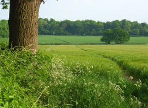
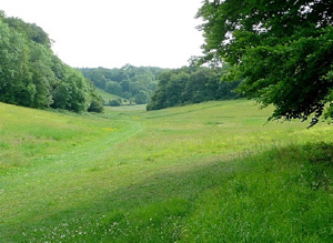
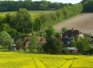
This area contains a series of dry valleys and watersheds between the Pang and Thames valleys and the high downs around Aldworth.
Parts of the area especially in the North have extensive tracts of little-modified pre 1800 landscape and retain considerable historic character. Earthworks and cropmarks of probable later prehistoric/Romano-British field systems exist over much of the Northern part of the area. There is a concentration of Medieval sites relating to Ashampstead Common which includes kilns.
North Wessex Downs AONB HLCA Extract 20
Present Day Historic Landscape Character

Parts of the area have extensive tracts of little-modified landscape and retain considerable historic character, whereas substantial change has occurred over much of the area creating a landscape with a new and different character.
The reorganisation of historic enclosures into fields suited to modern agriculture and the creation of extensive woodland plantations have been the two most substantial changes to the area.
Across the northern half of the area (North of Ashampstead) large areas of unmodified fieldscapes exist with only a small degree of field reorganisation and plantation. Changes in this part of the area have largely respected the grain of the landscape and much of the historic character remains intact.
Layers in the Landscape

In the North of the area there are numerous earthwork and cropmarked features thought to be of prehistoric date. The most visible is Grim’s Ditch, a probable Bronze Age territorial earthwork that runs between the Pang and Thames valleys. Grim’s Ditch exists for significant sections as an earthwork at Foxborough Copse and Portobello Wood and Holies Shaw and can be partially traced as a cropmark in between. Earthworks and cropmarks of probable later prehistoric/Romano-British field systems exist over much of the Northern part of the area.
Other Romano-British features, in addition to the field systems, have been found in the area. A villa has been observed as cropmarks North of Southridge Farm, it has not been excavated but has been speculatively dated it to the 2nd century on morphological grounds. Kilns were found near Lynch’s Copse during construction of the M4.
Medieval evidence is not widely distributed and this probably reflects the fact that most of the area was farmland, common and woodland during these periods. Bere Court was a residence of the Abbots of Reading established in the 13th century. It is now a house mostly dating from the 16th century and later, but incorporates some Medieval monastic elements. Yattendon Court deer park is thought to extend into this area at Old Park Woods, but it is unclear if any parkland features survive as the woods have been mechanically replanted. Many Medieval sites relate to Ashampstead Common and include finds and a kiln. A bank and ditch have been observed at several locations on the edges of Ashampstead and Burnthill Commons. It has been suggested that this is a previously unrecorded deer park, but it may be a boundary feature demarking the commons. Basildon Park contains remains of Medieval ridge and furrow and lynchets exist on the park’s lawns. This suggests that much of the park was laid out over open fields.
This area seems to have had a Medieval landscape characterised by small fields inter-related with woods and some commons. The combination of land-use and topography gave a very sinuous grain to the historic landscape of the area.
Most of the early enclosures were small irregularly-shaped fields, which suggest that they were created in an ad-hoc manner, perhaps over a long period of time. Many of the fields were probably created by Medieval assartment, or clearance of woodland. Burnthill and Ashampstead Commons, two areas of common heathland grazing, were located amidst the intimate network of fields and woods. Unlike many commons, these were not later enclosed. Ashampstead Common, however, had become substantially wooded-over by the end of the 19th century and was no longer an open heathland area.
This was a well-wooded area and most woods have been identified as ancient. Woods existed across the area but the highest concentration was in the South where a belt of several large woodlands existed. Large blocks of other old woods also existed in the middle of the area. Most woods had very irregular edges, as if they had had chunks taken out of them, and this was most visible between Yattendon and Bradfield. It is probable this is due to Medieval and later assartment. Some woodland clearance took place during the mid-19th century to create fields at Hewin’s Wood, Bradfield and College Wood and Westridge Green.
Historic Settlement Character

Settlement was less nucleated and more densely spread across the landscape than in adjacent areas. The historic settlement pattern was varied with dispersed settlements and farms across the South part of the area and mostly farms and a few hamlets in the North. Most settlement in the South was in hamlets, such as Upper Basildon, and common edge settlements around Burnthill and Ashampstead Commons.
Historic Farmstead Character
Farmsteads typically consist of loose courtyard plans with detached buildings arranged around a yard. Some 19th century farmsteads, built to house cattle for fattening or dairying are more likely to be of L-or U-plan. Historically, farms in this area were small and there is a high density of farmsteads in the landscape.


